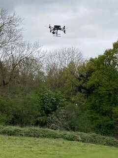
The drone survey of Hunsbury Hill Country Park and the Iron Age Hill Fort that was undertaken in April by heliguyTM from Northumberland for the Museum of London, Archaeology (MOLA) had some technical issues which has prevented MOLA processing the data.
A second survey has therefore been arranged for 15th November. This will again be a LIDAR* survey, set to capture the surface topography only, rather than any sub-surface features. LIDAR maps the ground, regardless of the tree and vegetation cover, although with less leaves on the trees in November, the survey should be more accurate than the one in April.
LIDAR surveys by drone are a non-invasive, quick, simple and relatively cheap method of surveying that will enable MOLA to determine any features in the park areas surrounding the Hill Fort (as well as in the fort itself, although due to the 19th century quarrying these are likely to be limited) that warrant further surveying, probably using ground penetrating radar or even excavation.
The survey results will also assist MOLA to compile our 2nd National Lottery Grant Bid for more archaeological research into the Iron age Hill Fort (and surrounding environment) and artefacts.
* LIDAR stands for Light Detection and Ranging and uses eye-safe laser beams to create a 3D representation of the surveyed environment. It is also referred to as laser scanning or 3D scanning.